Garth and Kathleen Holyoak will serve at BYU's Jerusalem Center from January, 2016, to August, 2017.
Sunday, October 9, 2016
Jordan (Part IV) Ajloun Castle
In the northern part of Jordan is the Ajloun Castle. It sits on a mountain and dates back to the Byzantine Period on the site of an old Christian monastery.
Photo: Castle on top of hill.
The castle was built in stages. The first was in 1183 when Salahuddin ordered the castle be built by his nephew and is one of the very few Muslim fortresses built to protect them from Crusaders and to control the iron mines of Ajlun and to deter the Franks from invading Ajlun. In the 12th century, it was captured by a Bedouin tribe and now belongs to the Ajloun Governorate (an administrative division of a country). It is headed by a governor who governs 27 villages and towns with a total population of 147,000. Families are referred to as "tribes" and population consists mainly of 11 Muslim tribe but one of the tribes divided into four and became Christian. Although Christians are a minority in the overall governorate, they form about more than half of the population in Ajloun city residing with Muslims of the Al-Smadi tribe.
The castle guarded three wadis (valleys) and protected routes leading to the Jordan Valley, controlling traffic along the road connecting Damascus and Egypt and routes between Jordan and Syria. It also became an important link in the defense against the Crusaders who spent decades trying to capture the castle and nearby village without success.
Originally there were four towers and the castle also protected nearby mining operations and was key to the manufacturing of weapons.
The Ajloun Castle secured the safety of pilgrim caravans traveling to the Hejaz. (Hejaz in Arabia is the site of the holiest shrines of Islam. The holy city of Mecca is the destination of the Hajaz annual pilgrimage.)
Photo: Pigeon box. Read the sign in the next photo regarding how pigeons were used for communication.
Maybe we should trash our cells phone and just buy some pigeons?
The Ajlun mountains are famous for their lush vegetation and thick green forests and a good place for hikes.
The castle was well prepared for many attacks. Several military defense systems were built into the castle. A dry moat surrounded it, making it difficult
to reach except through a gate.
Arrow slits can be seen in various levels of the towers and were one of the features of the castle.There were gaps left in the floor between the supporting stone corbels above the main gates so that stones, boiling water, or oil could be dropped
on any enemy soldiers. The towers were also important to the defense on the top levels so soldiers could drop down fire balls on attackers and could watch all the roads leading to the castle.
The castle was built on Salahuddin's command as part of the major military effort to stop the expansion of the Crusader territory.
The castle was beautiful inside and the cooler temperature was a welcome break.
Ten Salah ed-Din soldiers are guarding the castle every day of the week. They are placed at the four different gate levels that the castle has with two on the roof.
Jewelry made of Roman glass is a popular souvenir in Jerusalem. Many types of glass vessels were made and thousands of pieces of glass excavated have been made into pendants. Photo: Iron and bronze artifacts.
How would you like one of these dropped on you? (Ouch!) They were catapulted down on threatening invaders.
Being with students makes us feel younger. They are so full of energy and inspire us to put a little spring in our steps.
Give me a kiss but don't let the students see us.
Photo: Worn stone steps.
Photo: View from the top.
In 1926, there was a massive earthquake which caused massive damage to the castle.
Lunch time so it's time to leave.
Photo: Chef preparing a type of flat bread. We eat a lot of sandwiches made from flat or pocket bread.
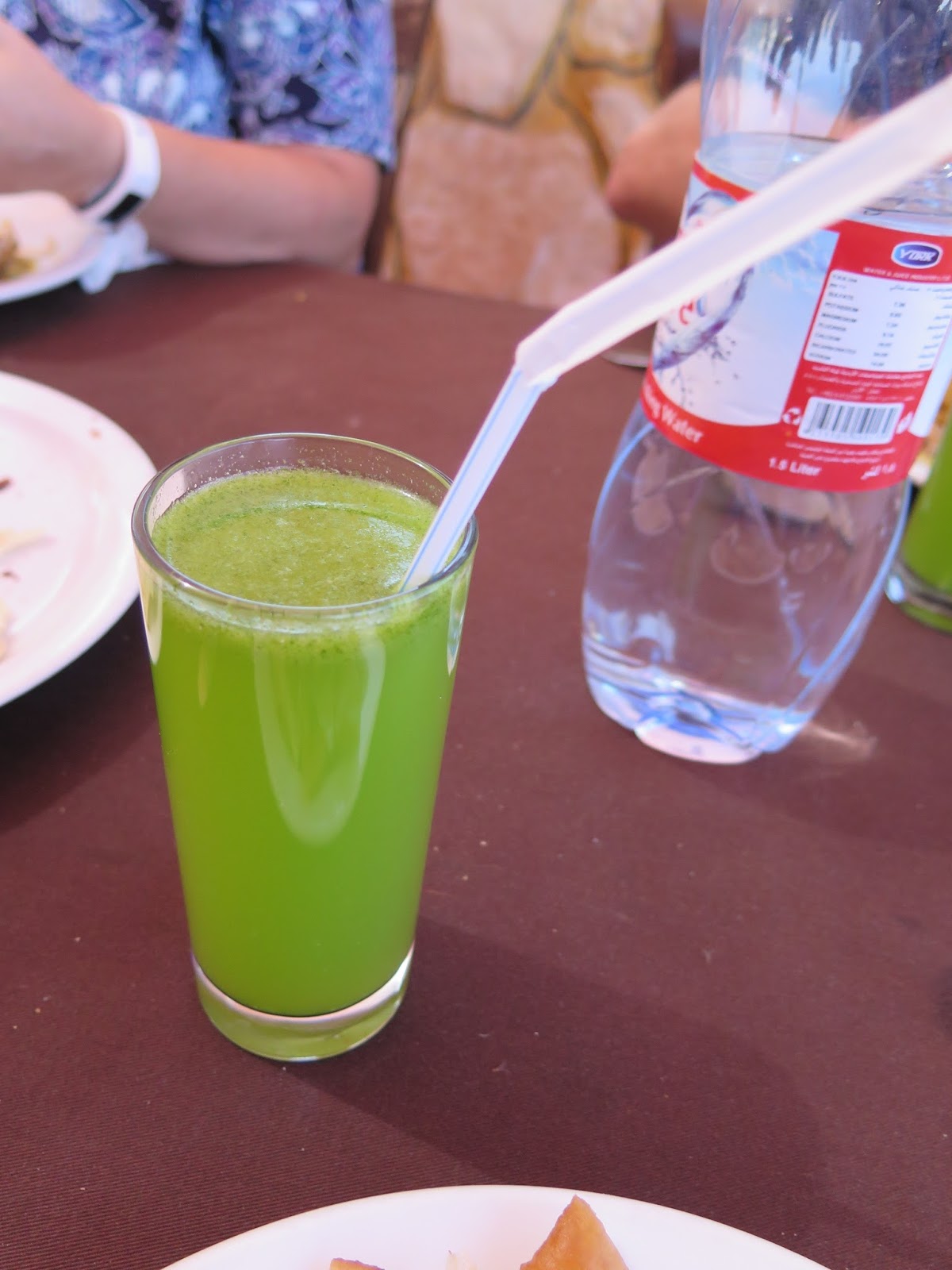
Photo: We had a buffet lunch but were told we should not eat salads and vegetables unless they were peeled. The reason for this is that we could only drink bottled water while in Jordan. However, I was so hungry for a salad, I could not contain myself and took a chance on the salad of cucumbers and tomatoes. I figured it might be safe since it was made with vinegar and vinegar kills bacteria. While eating, several observers said, "I hope you don't get sick." (Update: I was lucky and didn't get sick. Whew!)
Photo: This is a popular drink made from lemon/lime juice and mint leaves. There were too many leaves to suit my fancy!
Photo: Dessert.
The round balls were deep fried and were similar to dough nut holes.
Photo: View of the city from the restaurant.
Our next stop will be the King Abdullah I Mosque. (To be continued)
Sunday, October 2, 2016
Jordan (Part III)
Jerash is situated in the northern part of Jordan and about a 30 minute drive from Amman (the capital) and located near a tributary of the Jabbok River. With fertile land and a fresh water supply, the land prospered. However, earthquakes and wars destroyed this city and due to its arid location (lots of sand), it was wonderfully preserved until discovered in 1806. Abraham, an old Testament prophet, may have passed through a city called Jershon and scriptorians conclude it could possibly be another name for the ancient Jerash.
Jerash controlled the northern end of Kings Highway and therefore the inhabitants of this ancient city prospered through the taxing of Arabian goods and Nebataean wares that traveled this route. Jerash is considered one of the most important Roman cities in the Near East and was said to once have 60,000 inhabitants.
We entered through the south entrance and were surprised to find the best-preserved Roman ruins in the world! Built to commemorate the visit of the Emperor Hadrian to Jerash in 129 AD, this triumphal arch was intended to become the main gate to the city. The ancient city is graced with the Oval Plaza, two theaters, a Hippodrome, the Triumphant Gate, a fountain and temples including those devoted to Zeus and to Artemis.
Photo: Hadrian's Arch which was built in honor of its namesake and our students were excited for a group photo. Inhabited since the Bronze Age, we were about to learn that the ruins were from a Greco-Roman settlement.
Ancient Jerash was an open city (without fortification) of freestanding structures of richly embellished marble and granite. Its engineering was so advanced that large parts of the city still survive today.
Our students always seem to find creative ways to have their photos taken.
The Hippodrome is massive arena was 800' long and 170' wide and could seat 15,000 spectators for chariot races and other sports. Construction is estimated between the mid-2nd to 3rd century AD. There are regular enactments when gladiators and charioteers appear before crowds. I was lucky enough to snap a photo during a rehearsal.
Photo: A mosaic floor of a church.
Photo below: When we arrived at the South Theater, a group of musicians were waiting to entertain us and in a very conspicuous place, was a large tip box.
Photo: South Theater. The 1st level of the stage was originally a two-story structure but was reconstructed and is still used for special events today.
Built during the reign of Emperor Domitian, between 90-92 AD, the South Theater can seat more than 3,000 spectators.
After the musicians finished and collected tips, a guide explained that the theater's remarkable acoustics allow a performer at the center of the orchestra floor could be heard throughout the entire auditorium without raising his voice. Brianne, a JC student majoring in opera, demonstrated by singing a famous aria and we could hear her perfectly. It was pretty amazing considering it was such a large, open space.
As we walked along, we could see a large area of columns called the Oval Plaza. This magnificent plaza represents Jerash in its grandeur. The oval shape is unique and the plaza was actually built to connect the Cardo (the main street of Jerash) with the Sanctuary of Zeus. In order to join areas which were not aligned, the street was widened into an oval shape in front of the main access to the sanctuary.
Photo: Looking down on the Oval Plaza from a hilltop nearby.
Photo: Remaining top pieces of columns in the Cardo.
Photo: The Cardo was the main street of Jerash. The Cardo was lined with a broad sidewalk and shops and an underground sewage system ran the full length of the street into which rainwater was channeled through holes on both sides of the street. It is still paved with its original stones and bears the ruts of chariot wheels. As part of a remodeling of the street around 170 AD, the original Ionic columns were replaced with more decorative Corinthian colonnades.
Photo: This photo gives you a better perspective of the Oval Plaza looking down from the Temple of Zeus. Because the ancient city had an estimated 60,000 imhabitants, more than 15 churches have been discovered. In 614 the Persians invaded Jerash, in 636 the Arab-Muslims conquered it and in 749 an earthquake caused massive destruction.
Photo: Temple of Zeus.
This is the gateway of a 2nd century Roman Temple of Dionysus. In the 4th century the temple was rebuilt as a Byzantine church now referred to as the Cathedral.
Corinthian columns of the hilltop of the Temple of Artemis rise upward 50' and those columns dominated the city.
Photo: Ancient inscription on stone.
Photo: A new water wheel built to replace the original one.
After a couple of hours at Jerash, everyone was anxious return to our air conditioned buses. Despite the heat, we loved seeing the ruins and learning about the history of this amazing ancient city. Our next stop will be the Ajloun Castle. (Part IV)
Jerash controlled the northern end of Kings Highway and therefore the inhabitants of this ancient city prospered through the taxing of Arabian goods and Nebataean wares that traveled this route. Jerash is considered one of the most important Roman cities in the Near East and was said to once have 60,000 inhabitants.
We entered through the south entrance and were surprised to find the best-preserved Roman ruins in the world! Built to commemorate the visit of the Emperor Hadrian to Jerash in 129 AD, this triumphal arch was intended to become the main gate to the city. The ancient city is graced with the Oval Plaza, two theaters, a Hippodrome, the Triumphant Gate, a fountain and temples including those devoted to Zeus and to Artemis.
Photo: Hadrian's Arch which was built in honor of its namesake and our students were excited for a group photo. Inhabited since the Bronze Age, we were about to learn that the ruins were from a Greco-Roman settlement.
Ancient Jerash was an open city (without fortification) of freestanding structures of richly embellished marble and granite. Its engineering was so advanced that large parts of the city still survive today.
Our students always seem to find creative ways to have their photos taken.
The Hippodrome is massive arena was 800' long and 170' wide and could seat 15,000 spectators for chariot races and other sports. Construction is estimated between the mid-2nd to 3rd century AD. There are regular enactments when gladiators and charioteers appear before crowds. I was lucky enough to snap a photo during a rehearsal.
Photo: South Theater. The 1st level of the stage was originally a two-story structure but was reconstructed and is still used for special events today.
Built during the reign of Emperor Domitian, between 90-92 AD, the South Theater can seat more than 3,000 spectators.
After the musicians finished and collected tips, a guide explained that the theater's remarkable acoustics allow a performer at the center of the orchestra floor could be heard throughout the entire auditorium without raising his voice. Brianne, a JC student majoring in opera, demonstrated by singing a famous aria and we could hear her perfectly. It was pretty amazing considering it was such a large, open space.
As we walked along, we could see a large area of columns called the Oval Plaza. This magnificent plaza represents Jerash in its grandeur. The oval shape is unique and the plaza was actually built to connect the Cardo (the main street of Jerash) with the Sanctuary of Zeus. In order to join areas which were not aligned, the street was widened into an oval shape in front of the main access to the sanctuary.
Photo: Looking down on the Oval Plaza from a hilltop nearby.
Photo: Remaining top pieces of columns in the Cardo.
Photo: The Cardo was the main street of Jerash. The Cardo was lined with a broad sidewalk and shops and an underground sewage system ran the full length of the street into which rainwater was channeled through holes on both sides of the street. It is still paved with its original stones and bears the ruts of chariot wheels. As part of a remodeling of the street around 170 AD, the original Ionic columns were replaced with more decorative Corinthian colonnades.
Photo: This photo gives you a better perspective of the Oval Plaza looking down from the Temple of Zeus. Because the ancient city had an estimated 60,000 imhabitants, more than 15 churches have been discovered. In 614 the Persians invaded Jerash, in 636 the Arab-Muslims conquered it and in 749 an earthquake caused massive destruction.
Photo: Temple of Zeus.
This is the gateway of a 2nd century Roman Temple of Dionysus. In the 4th century the temple was rebuilt as a Byzantine church now referred to as the Cathedral.
Corinthian columns of the hilltop of the Temple of Artemis rise upward 50' and those columns dominated the city.
Photo: A new water wheel built to replace the original one.
After a couple of hours at Jerash, everyone was anxious return to our air conditioned buses. Despite the heat, we loved seeing the ruins and learning about the history of this amazing ancient city. Our next stop will be the Ajloun Castle. (Part IV)
Subscribe to:
Posts (Atom)